Lefkogia - Agia Galini,
Central Crete
The ~38-kilometer journey from Lefkogia to Agia Galini is a premier coastal expedition that tracks the sapphire waters of the Libyan Sea. This paved route is a "beach-hopper's" dream, connecting hidden coves, massive sand dunes, and historic ports along the diverse middle-south coastline of Crete.
1. The Departure from Lefkogia
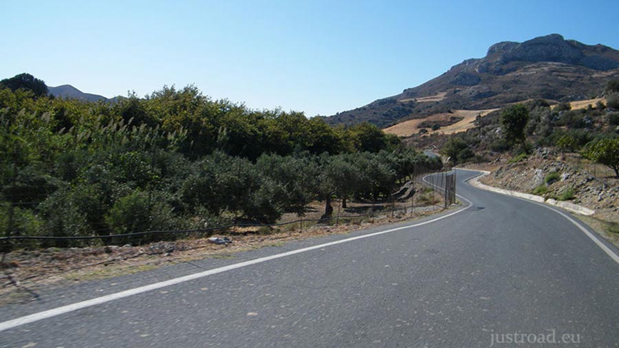
The route begins at the junction near the village of Lefkogia, heading toward the historic Preveli area. Note for Navigators: Please be aware that the first 2.8 kilometers of this route—leading from Lefkogia down toward the famous Stone Bridge of Preveli—will not appear on the digital map displayed below. Simply follow the physical road signs toward Preveli to begin the journey. Also note that some pictures are older, showing unpaved road, but thats not the case anymore
2. The Preveli Landmark
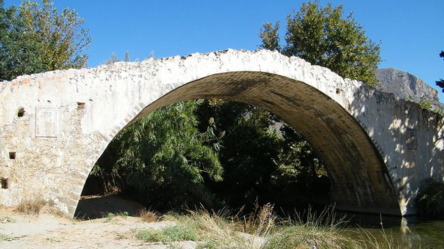
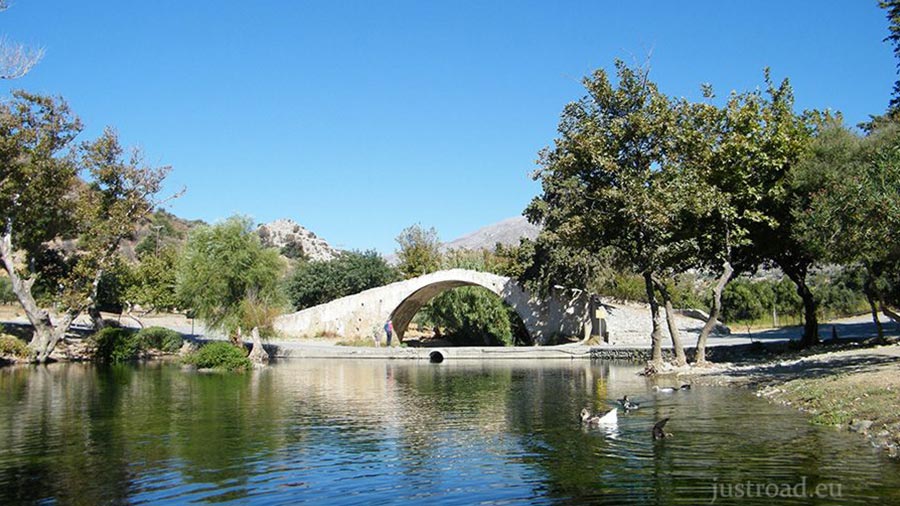
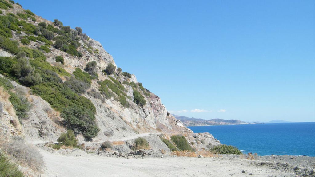
The first few kilometers take you down toward the Megalopotamos River. Once you pass the iconic 18th-century stone bridge, although the road is paved, the descent toward the Preveli area features sharp turns and steep gradients that require attentive driving.
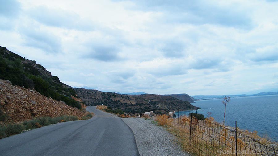
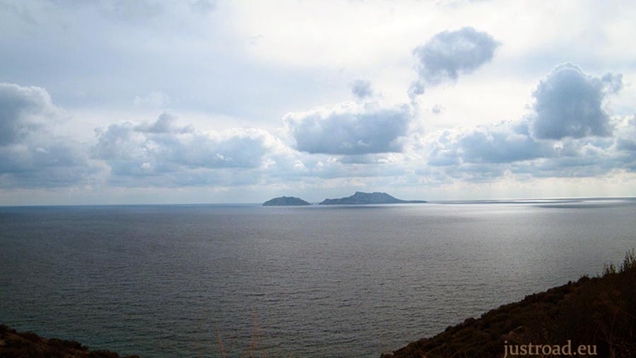
3. The Middle-South Coastline
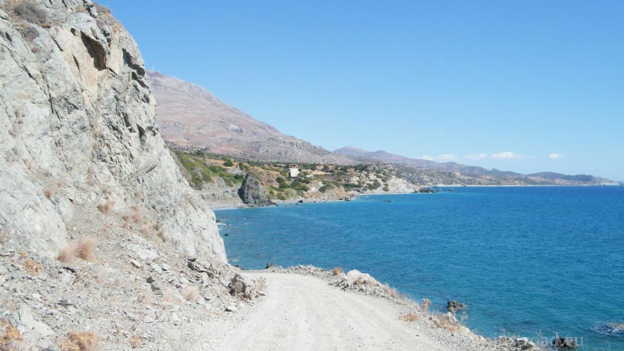
After leaving the Preveli area, the route becomes a spectacular coastal drive. You will pass a succession of diverse beaches. The traffic on these roads highly depends on the time of year, but it is rarely a problem, allowing you to enjoy the wide-angle views of the Libyan Sea in relative peace.
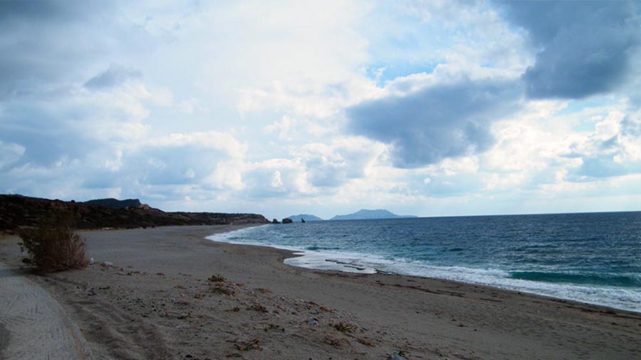
4. The Dunes of Agios Pavlos
As you move further east, the road passes near Agios Pavlos, home to massive, prehistoric sand dunes that "melt" into the sea. This is a perfect mid-point to stop; the scale of the golden dunes against the deep blue water is one of the most breathtaking sights in Southern Crete. From here, the road continues through a rugged, sun-drenched landscape that feels beautifully isolated.
5. Arrival at Agia Galini
The route concludes with a scenic approach into Agia Galini. Once a quiet fishing village, it has transformed into a picturesque tiered port town, with white-washed houses built into the hillside overlooking the harbor. The arrival provides a welcoming change of pace, with plenty of coastal taverns to celebrate the completion of the ~38-kilometer trek.
Whispers of the Coast: Local Secrets
The Stone Bridge: The bridge near the start of your route was built by local monks in 1850. It’s a masterpiece of traditional masonry crossing the "Grand River."
The "Three Rocks": Triopetra is named after the three massive rock formations that emerge from the sea. They are an incredible geological landmark and a great spot for snorkeling.
The Legend of Icarus: Local lore says that Agia Galini is the spot from which Daedalus and Icarus took flight to escape King Minos. You can find a monument dedicated to them overlooking the harbor.
Rider’s Notes
Road Width: Standard two-lane paved road for the majority of the route, though it can get rather narrow in several occasions especially during the initial descent and near village entrances.
Surface: Fully paved asphalt. While the road is in good condition, be mindful of occasional wind-blown sand on the surface near the beach sections.
Info box
Surface: Asphalt
Road classes: C road, Unclassified
Terrains: Coastal
Traffic: Light
Coordinates start (DD): 35.179007, 24.444219
Coordinates end (DD): 35.097201, 24.686795