
Spili - Gerakari,
Central Crete
The 10-kilometer mountain pass from Spili to Gerakari is a refreshing, high-altitude journey that connects two of Rethymno's most authentic villages. This asphalt route serves as a scenic bridge between the southern coast road and the heart of the Amari area, winding along the northern foothills of Mount Kedros.
1. Departing the Lion’s Village
The route begins at the edge of Spili, a village famous for its "Kefalovrisi"—the 25 Venetian lion-head fountains that gush ice-cold spring water year-round. As you head east, the road immediately begins a gentle but steady climb. Looking back, you get a bird’s-eye view of Spili’s red-tiled roofs nestled against the grey limestone cliffs of Vorizi Mountain.
2. The Slopes of Mount Kedros
The road hugs the northern face of Mount Kedros (1,776m). This section of the drive is characterized by exceptionally green landscapes, a rarity for Crete in the late summer. You will pass through a patchwork of silver olive groves and pockets of Mediterranean oak. The asphalt here is smooth and winding, offering a rhythmic driving experience with constant views of the Amari Valley opening up to your left.
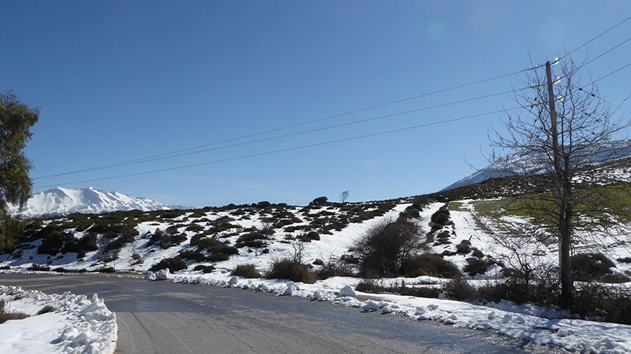
3. The Gateway to the Valley
As you approach the 8-kilometer mark, the terrain levels out into a high mountain shelf. The air here is noticeably cooler and crisper. To the north, the massive silhouette of Mount Psiloritis (Mount Ida) dominates the horizon, often capped with snow well into May. This is the "Reveal" of the route: the transition from the rugged canyons of the south to the fertile, fruit-bearing heart of central Crete.
4. Arrival in the Cherry Capital
The route concludes in Gerakari, a village sitting at 680 meters elevation. Known as the "Cherry Village" of Crete, Gerakari is a paradise of orchards and fresh running water. The arrival is marked by the sight of thousands of cherry, apple, and walnut trees that turn the village white with blossoms in the spring and deep red with fruit in June.
Whispers of the Mountain: Local Secrets
The Iron Water: The springs in this area are famous for their high iron content. Locals believe the water between Spili and Gerakari is the purest on the island.
A Village Reborn: Gerakari is a "Martyr Village." It was completely destroyed in 1944 during WWII and rebuilt from the ashes, now standing as a model of Cretan resilience.
Wild Tulips: If you drive this route in late March or early April, look for the rare red tulips (Tulipa doerfleri) that carpet the nearby Gious Kampos plateau.
Rider’s Notes
Road Width: Standard two-lane mountain road. It is generally wide enough for easy passing, though some corners near the village entrances can tighten up.
Surface: High-quality asphalt. This is a "flowy" route that rewards smooth leaning rather than aggressive braking.
Difficulty: An easy and relaxing mountain drive. The main "hazard" is the distraction caused by the panoramic views of Psiloritis.
Caution: The road can be damp and slippery in the early morning due to mountain mist, especially in the shaded sections under the Kedros peaks.
Info box
Surface: Asphalt
Road classes: B road
Terrains: Mountainous
Traffic: Almost none
Coordinates start (DD): 35.220148,24.531065
Coordinates end (DD): 35.214101,24.606038